There are now 64 grids available in this package and more online. To view a full list of available grids, see here. To create and submit your own grid, see here. To see several examples of grids being used to visualize data, see facet_geo.
us_state_grid1: Grid layout for US states (including DC) Image reference here.
us_state_grid2: Grid layout for US states (including DC) Image reference here.
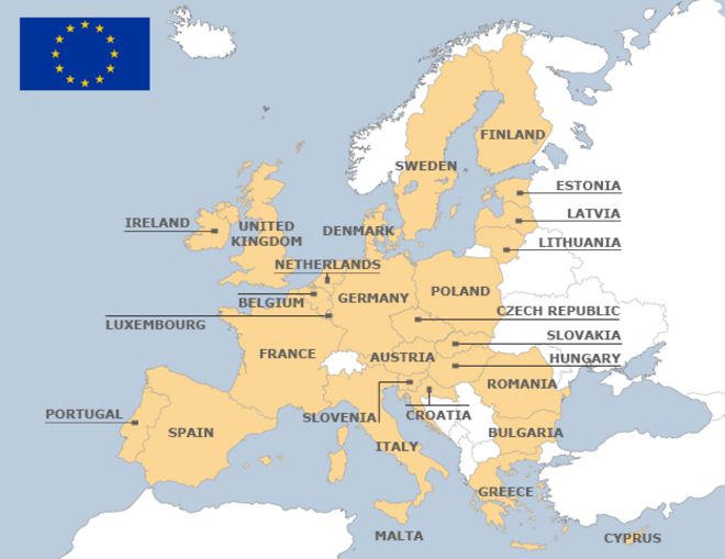
eu_grid1: Grid layout for the 28 EU Countries Image reference here.
aus_grid1: Grid layout for the Australian States and Territories. Image reference here. Thanks to jonocarroll.
sa_prov_grid1: Grid layout for the provinces of South Africa Image reference here. Thanks to jonmcalder.
london_boroughs_grid: Grid layout for the boroughs of London. Note that the column code_ons contains the codes used by UK Office for National Statistics. Image reference here. Thanks to eldenvo.
nhs_scot_grid: Grid layout for a grid of NHS Scotland Health Boards. Note that the column code contains the codes used by UK Office for National Statistics. Image reference here. Thanks to jsphdms.
india_grid1: Grid layout for India states (not including union territories). Image reference here. Thanks to meysubb.
india_grid2: Grid layout for India states (not including union territories). Image reference here.
argentina_grid1: Grid for the 23 provinces of Argentina. It includes the Malvinas/Falkland Islands and the Antarctic Territories (these are disputed, but they are included since many researchers might use data from these locations). Image reference here. Thanks to eliocamp.
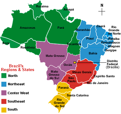
br_states_grid1: Grid for the 27 states of Brazil. Image reference here. Thanks to italocegatta.
fr_regions_grid1: Land and overseas regions of France. Codes are INSEE codes. Image reference here. Thanks to mtmx.
de_states_grid1: Grid for the German states ('L<U+00E4>nder') Image reference here. Thanks to DominikVogel.
us_wa_counties_grid1: Grid for Washington counties. Image reference here.
us_in_counties_grid1: Grid for Indiana counties. Image reference here. Thanks to nateapathy.
us_in_central_counties_grid1: Grid for central Indiana counties. Image reference here. Thanks to nateapathy.
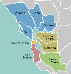
sf_bay_area_counties_grid1: Grid of the 9 San Francisco Bay Area counties. Image reference here. Thanks to Eunoia.
ua_region_grid1: Grid of administrative divisions of Ukraine (24 oblasts, one autonomous region, and two cities). Image reference here. Thanks to woldemarg.
mx_state_grid1: Grid layout for the states of Mexico. Image reference here. Thanks to ikashnitsky.
mx_state_grid2: Grid layout for the states of Mexico. Image reference here. Thanks to diegovalle.
scotland_local_authority_grid1: Grid layout for the local authorities of Scotland. Image reference here. Thanks to davidhen.
italy_grid1: Grid layout for regions of Italy (in collaboration with Stella Cangelosi and Luciana Dalla Valle). Image reference here. Thanks to JulianStander.
italy_grid2: Grid layout for regions of Italy (in collaboration with Stella Cangelosi and Luciana Dalla Valle). Image reference here. Thanks to JulianStander.
be_province_grid1: Grid layout for provinces of Belgium plus Brussels, including names in three languages (French, Dutch, English) and Belgium internal codes (NIS). Image reference here. Thanks to ericlecoutre.
us_state_grid4: Grid layout for US states (including DC). Image reference here. Thanks to kanishkamisra.
ng_state_grid1: Grid layout for the 37 Federal States of Nigeria. Image reference here. Thanks to ghosthedirewolf.
bd_upazila_grid1: Grid layout for Bangladesh 64 Upazilas. Image reference here. Thanks to ghosthedirewolf.
ch_cantons_grid1: Grid layout for Cantons of Switzerland. Image reference here. Thanks to tinu-schneider.
world_86countries_grid: Grid layout for 86 countries in the world. Image reference here. Thanks to akangsha.
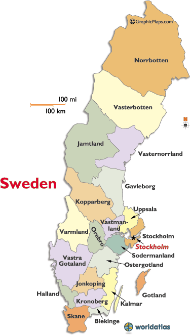
se_counties_grid2: Grid for counties of Sweden. Image reference here. Thanks to richardohrvall.
uk_regions1: Grid for regions of the UK (aka EU standard NUTS 1 areas). Image reference here. Thanks to paulb20.
us_state_contiguous_grid1: Grid layout for the contiguous US states (including DC). Image reference here. Thanks to andrewsr.
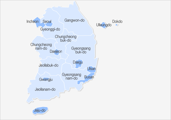
sk_province_grid1: Grid layout for South Korean sis and dos (metropolitan/special/autonomous cities and provinces). Image reference here. Thanks to heon131.
ch_aargau_districts_grid1: Grid layout for Districts of the Canton of Aargau, Switzerland. Image reference here. Thanks to zumbov2.
jo_gov_grid1: Grid layout for Governorates of Jordan. Image reference here. Thanks to ghosthedirewolf.
spain_ccaa_grid1: Grid layout for Spanish 'Comunidades Aut<U+00F3>nomas'. Image reference here. Thanks to JoseAntonioOrtega.
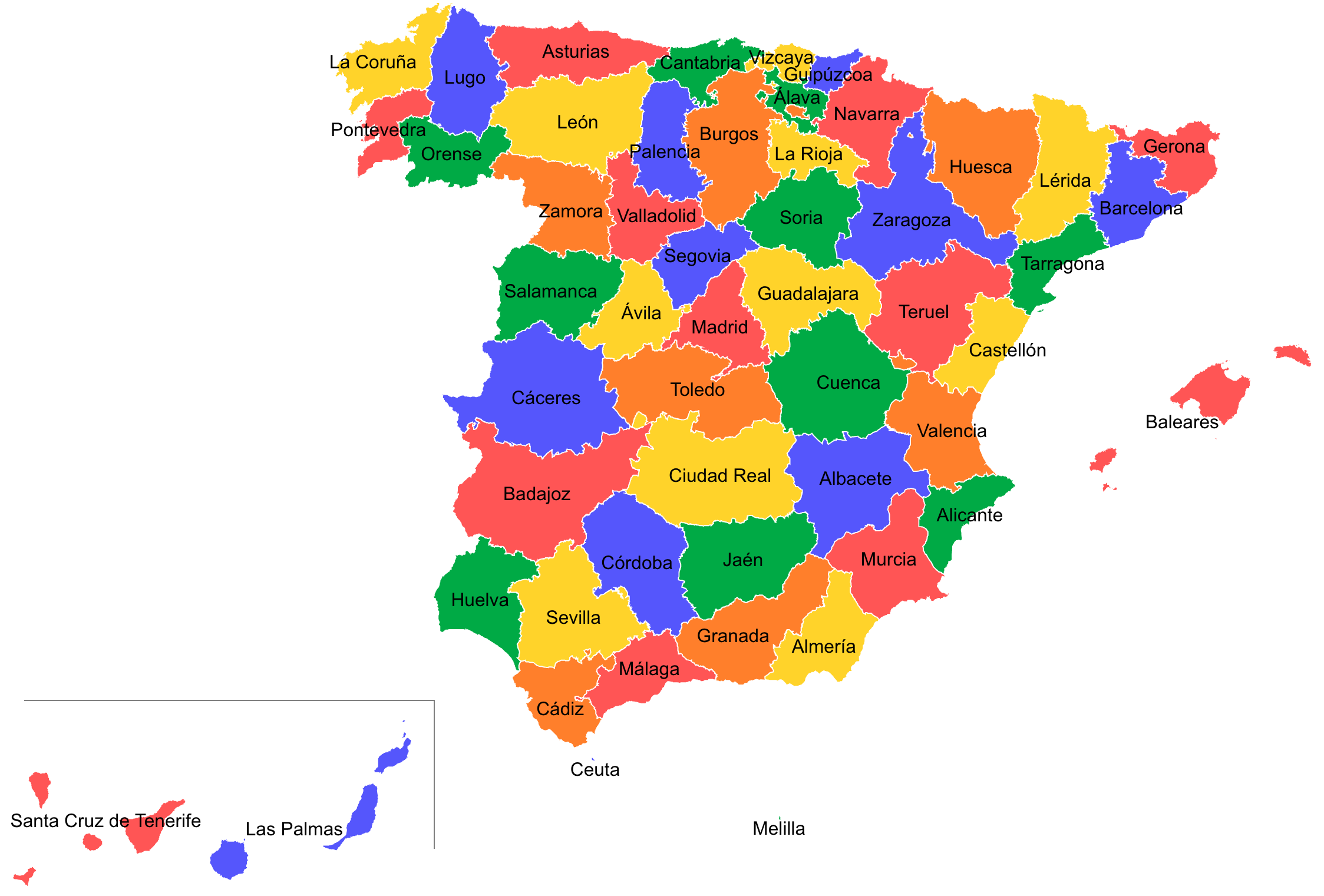
spain_prov_grid2: Grid layout for Provinces of Spain. Image reference here. Thanks to JoseAntonioOrtega.
world_countries_grid1: Grid layout for countries of the world, with a few exclusions. See . Image reference here. Thanks to JoseAntonioOrtega.
china_city_grid1: Grid layout of cities in China. Image reference here. Thanks to CharleneDeng1.
kr_seoul_district_grid1: Grid layout of Seoul's 25 districts. Image reference here. Thanks to yonghah.
nz_regions_grid1: Grid layout for regions of New Zealand. Image reference here. Thanks to pierreroudier.
ar_tucuman_province_grid1: Grid layout for Argentina Tucum<U+00E1>n Province political divisions (departments) Image reference here. Thanks to TuQmano.
us_nh_counties_grid1: Grid layout for the 10 counties in New Hampshire. Image reference here. Thanks to soungl.
pl_voivodeships_grid1: Grid layout for Polish voivodeships (provinces) Image reference here. Thanks to erzk.
ar_cordoba_dep_grid1: Grid layout for departments of Cordoba province in Argentina. Image reference here. Thanks to TuQmano.
ar_buenosaires_communes_grid1: Grid for communes of Buenos Aires, Argentina. Image reference here. Thanks to TuQmano.
nz_regions_grid2: Grid layout for regions of New Zealand. Image reference here. Thanks to pierreroudier.
us_state_grid1us_state_grid2
eu_grid1
aus_grid1
sa_prov_grid1
london_boroughs_grid
nhs_scot_grid
india_grid1
india_grid2
argentina_grid1
br_states_grid1
sea_grid1
mys_grid1
fr_regions_grid1
de_states_grid1
us_or_counties_grid1
us_wa_counties_grid1
us_in_counties_grid1
us_in_central_counties_grid1
se_counties_grid1
sf_bay_area_counties_grid1
ua_region_grid1
mx_state_grid1
mx_state_grid2
scotland_local_authority_grid1
us_state_grid3
italy_grid1
italy_grid2
be_province_grid1
us_state_grid4
jp_prefs_grid1
ng_state_grid1
bd_upazila_grid1
spain_prov_grid1
ch_cantons_grid1
ch_cantons_grid2
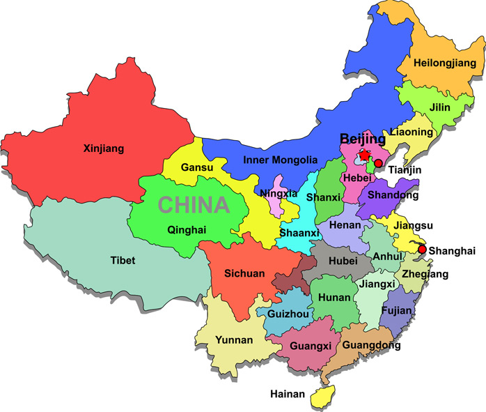
china_prov_grid1
world_86countries_grid
se_counties_grid2
uk_regions1
us_state_contiguous_grid1
sk_province_grid1
ch_aargau_districts_grid1
jo_gov_grid1
spain_ccaa_grid1
spain_prov_grid2
world_countries_grid1
br_states_grid2
china_city_grid1
kr_seoul_district_grid1
nz_regions_grid1
sl_regions_grid1
us_census_div_grid1
ar_tucuman_province_grid1
us_nh_counties_grid1
china_prov_grid2
pl_voivodeships_grid1
us_ia_counties_grid1
us_id_counties_grid1
ar_cordoba_dep_grid1
us_fl_counties_grid1
ar_buenosaires_communes_grid1
nz_regions_grid2
oecd_grid1